Examples
Basic Map
Map with Title
Custom Height
Custom Zoom Level
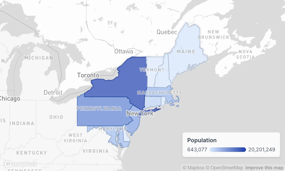
Map with Choropleth Layer
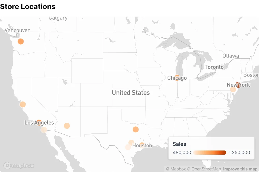
Map with Point Layer
Map with Heatmap Layer
Attributes
Title to display above the map
Subtitle to display below the title
Information tooltip text (can only be used with title)
URL to link the info text to (can only be used with info)
Create a custom link title for the info link, placed after the info text (can only be used with info_link)
Height of the map in pixels
Initial map center position as [latitude, longitude]. Overrides auto-zoom to data bounds
Zoom level (0-22, where higher is more zoomed in). When provided without initial_position, centers on data at this zoom level. When provided with initial_position, uses this zoom at that position
Allow users to zoom in/out on the map
Allow users to pan/drag the map
Base map style: “mono” for theme-aware monochrome basemap, “blank” for solid background only. Named OpenFreeMap styles (positron, bright, liberty, dark, fiord) are theme-fixed and fall back to “mono” when maps are served by MapboxAllowed values:
monoblankpositronbrightlibertydarkfiord
Map projection: “globe” for 3D globe view, “flat” for 2D flat mapAllowed values:
globeflat
Show legends for map layers
Location of the legend within the mapAllowed values:
top_lefttop_rightbottom_leftbottom_right
Set the width of this component (in percent) relative to the page width